Features BatNav - Marine navigation
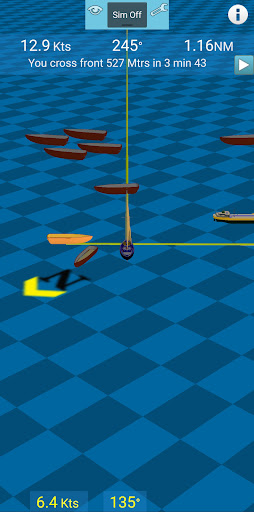
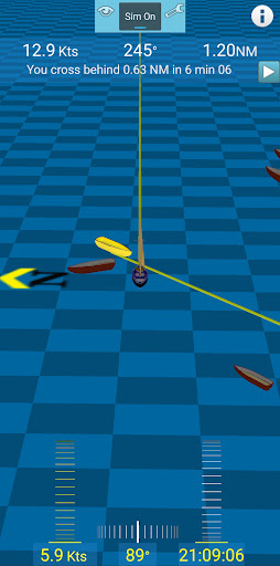
Uses the AIS and GPS on your existing instruments to show your position and other boats in your vicinity in a 3D graphics view.
Calculates how close you get to other boats and determines whether you pass in front or behind.
In simulation mode, it can show you where you will be in the future relative to other boats.
In this mode, you can also test scenarios such as changing your speed or direction.It is recommended to try the free BatNav demo version to ensure compatibility with your boat hardware before purchasing the full version.
Fitness Tracking
Track your workouts and monitor your health metrics.
Travel Features
Plan and manage your travels with ease.
Lightning Fast
Experience blazing fast performance with our optimized Android application.
See the BatNav - Marine navigation in Action

Get the App Today
Available for Android 8.0 and above